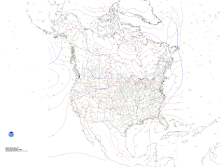
High pressure remains over the Commonwealth and the Mid-Atlantic Wednesday. Sunny skies, gradually warming temperatures, and a return to Southeasterly winds will be the result of this high pressure in our region. With such pleasant conditions, there must be an opposite somewhere, like the balanced yin and yang.
(Click to enlarge)

Sure enough, the Sunshine State remains under the influence of the low pressure system parked just off Southwest Florida. This storm system is barely drifting westward at the moment, and continues to spin over the state, dumping inch upon inch of rain. Check out some of the totals so far from this system.
...SELECTED STORM TOTAL RAINFALL IN INCHES FROM 800 AM EDT MON MAY18 THROUGH 500 AM EDT WED MAY 20...
NW PALM COAST 12.20"
PIERSON 10.17"
UMATILLA 9.24"
DAYTONA BEACH 9.1 WSW 9.06"
ORMOND BEACH 3.5 SE 8.76"
DE LEON SPRINGS 0.4 SE 8.07"
ST. AUGUSTINE SOUTH 2.1 SSW 7.87"
ST. AUGUSTINE SHORES 0.7 ESE 7.65"
SANFORD/ORLANDO 7.10"
DE LAND 5.7 NW 7.06"
HASTING 6.54"
APOPKA 6.23"
OKAHUMPKA 6.21"
DELTONA 2.9 SE 5.71"
NEW SMYRNA BEACH 1.5 E 5.47"
MELBOURNE 8.2 NW 5.27"
PALM SHORES 1.4 W 5.18"
HOMESTEAD AFB 4.17"
LEESBURG MUNI ARPT 3.98"
DOVER 3.74"
BROOKSVILLE 3.68"
VERO BEACH MUNI ARPT 3.37"
FORT PIERCE/ST LUCIE 3.27"
MIAMI 4.1 SE 3.06"
Yowza, that's a lot of rain for Florida!
The low will gradually drift westward through the Gulf of Mexico, but it will take its sweet time and continue to unleash heavy rain on Florida. Here are the forecast totals through the end of this week:
That's another six inches possible on top of up to a foot of rain that has already fallen in Northeast Florida. High pressure over the Mid-Atlantic (what's bringing us the pleasant, dry weather) will steer the low westward, steering clear of us. The low will eventually weaken over the Gulf Southeast States.
--Carrie


No comments:
Post a Comment